
(in front of Pasadena High School)
Explore Washington Boulevard from Sierra Madre Boulevard to Fair Oaks Avenue – a significant tour of central Pasadena. There are lots of interesting old and new businesses especially on this route.
About 3.8 miles one way, double that if you do it round trip. (or Bus #268 can take you back near PHS – Orange Grove/Sunny Slope).
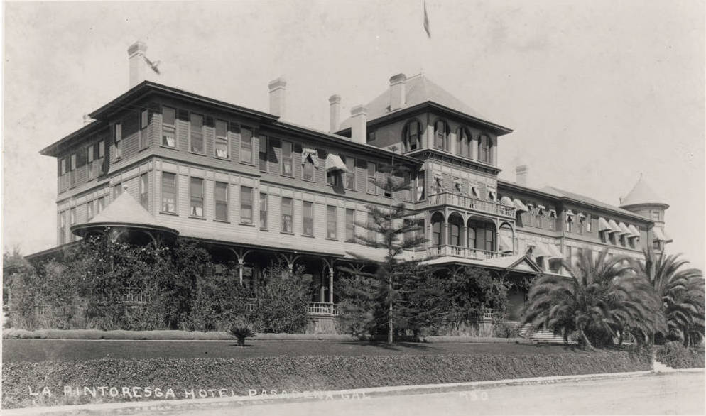
Some things I’ve learned about Washington Boulevard from Wikipedia: Washington Boulevard was constructed in the early 20th Century to facilitate vehicular access to the Hotel La Pintoresca at Fair Oaks & Washington, and to service riders on the East Washington Streetcar line. The line ran for 2.5 miles between Los Robles Avenue and Santa Anita Avenue. Washington Boulevard originally terminated at Arroyo Boulevard and Altadena Drive. An extension west to Linda Vista was built in the 1940s and another southeast to Pasadena High School in the 1960s.


 The walk: From the parking lot, we’ll cross the street and head south where we’ll leave the road at a trail map sign to drop down under the 134 Freeway bridge and the Colorado street bridge. There is running water, trees, wildlife, and the path is uneven in places with one short steep section. Once we cross under the bridges, the path becomes flat with a packed dirt surface and follows the arroyo “river”. We will pass the archery range, the “camel’s hump”, the stables, and finally we will end up in South Pasadena at the Lower Arroyo Park. We’ll cross the bridge, and return on the other side.


 A few of us will be meeting up for a walk the Rose Bowl tomorrow (Saturday) Jan 17, 2015 at 9:30AM. We’ll meet at the benches outside the Aquatic center. No need to RSVP. For those just getting started “Walking Pasadena”, this is a GREAT way to get out there and get going – I find walking the Rose Bowl on a Saturday morning very motivating!